Research
Spatiotemporal analysis of heavy precipitation events and development of an evacuation route optimization system
The scale of heavy rainfall is expected to increase further due to climate change, and large-scale floods such as the July 2008 torrential rains have occurred in many parts of Japan in recent years. In this laboratory, we are conducting spatio-temporal analysis of the characteristics of heavy rainfall that causes flood damage using a high-resolution precipitation data over the past 90 years. Furthermore, in order to mitigate damage after a flood occurs, we are also working on the construction of a system that enables real-time search of optimal evacuation routes to evacuation centers when there is a flood risk to nearby residents.
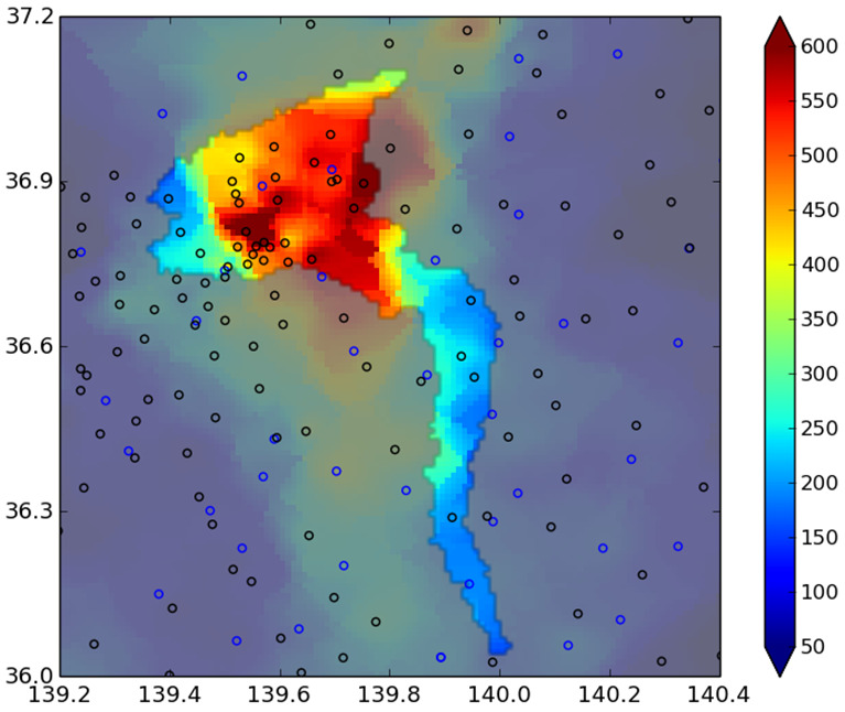
3-day precipitation in the Kinu River basin during Sep. 2015 Kanto-Tohoku Heavy Rain
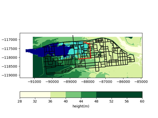
Evacuation route search considering inundation expansion (Blue to light blue)
Physical prediction of sediment grain motion, topographic changes, and global sediment dynamics
Water flowing through a river moves the sands and gravels in the riverbed and changes the topography. Riverbank erosion scours roads, riverbed aggradation contributes to flooding, and debris flow from mountainous areas crush houses. Therefore, to consider effective flood control, we need to understand the processes of sediment transport and landform evolution. In this laboratory, we are working to develop new applications for physically understanding and predicting global-scale, wide-area sediment dynamics, the formation processes of meanders and fans, and the sorting and transport mechanisms of sand and gravel.
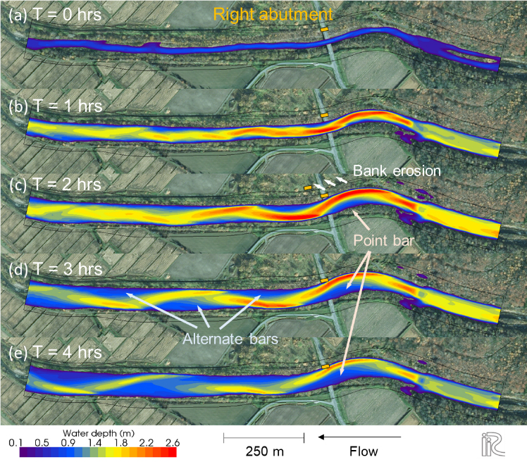
Simulation of bridge collapse due to bank erosion
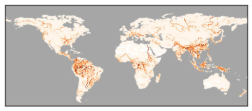
Annual suspended load of the world
Elucidation of flow and turbulence characteristics in open-channel flow and development of analysis method
Based on the idea that depth-scale vortical motions generated by bottom shear forces dominate the interaction between shallow flow over a wide area and three-dimensional turbulent motions, this laboratory aims at a unified interpretation of the flow and turbulence characteristics of open channels and the systematization of hydraulic analysis methods. The main purpose of river flow analysis, such as flood flow, is to evaluate the water surface height for flood risk prediction and the sediment transport by water flow for temporal variation in river bed topography and local scour prediction. We have developed and improved the BVC method focusing on eddy motion at the water depth scale. In addition, we are developing a dynamic resistance law to evaluate the forces acting on resistive elements in water flow, such as the bottom, walls, and vegetation, and studying flow and sediment transport analysis methods using the law. On the other hand, the complex behavior of water surface particles, such as wave breaking, greatly changes the energy form of the entire flow field in the case of stepped waves such as hydraulic jump downstream of structures and tsunamis, and we are investigating the interaction between these particles and the river channel planform, as well as the surface flow field and its analysis methods.
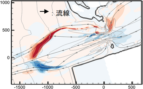
Large-scale secondary flow structure at the mouth of a river analyzed by flood flow analysis.
Red represents rightward vortices and blue represents leftward vortices.
The left side shows the river mouth terrace, and the right side shows the opposite pair of secondary flows near the river mouth sandbar.
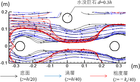
Results of streamline analysis around a submerged boulders group.
Black and blue are streamlines passing through the riverbed surface, and red is a streamline passing through the gravel bed, which is widely affected by the horseshoe vortex.